rooney.design
Wireless Deployment Planner
A substantial cost to deploying a broadband network in a new metro is the planning stage, which in a conventional deployment plan will consist of significant man-hours spent surveying, field testing, and troubleshooting. This web-based tool uses predictive models & basic raytracing to estimate path loss of a wireless deployment according to environmental factors (morphology, natural obstructions, etc.) and install parameters (height, orientation, etc.).
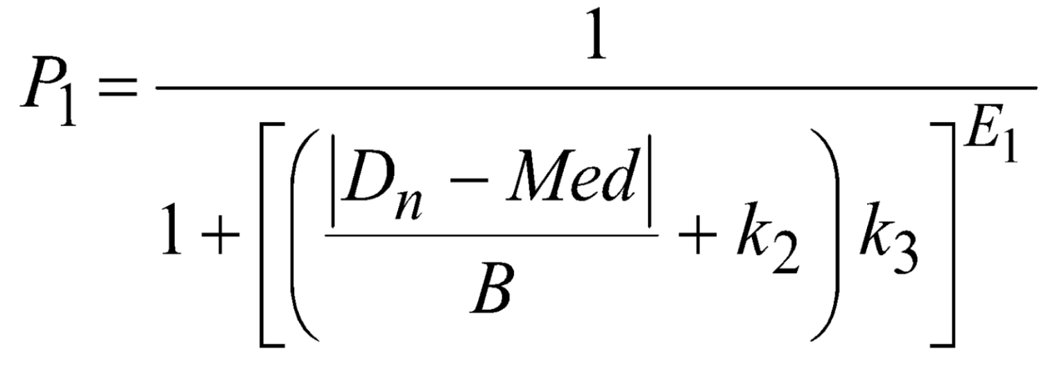
In other words, it took the equations that the rocket scientists gave me, like this one:
And turned them into a simple, visual click+drag workflow that
a single network engineer can use to easily conduct preliminary evaluations right from his chair.

Complex Problem, Simplified Solution
No more complex mathematical models and confusing CSV files. Add the proposed radios to the map, set the install parameters, and click run. That's all it takes.

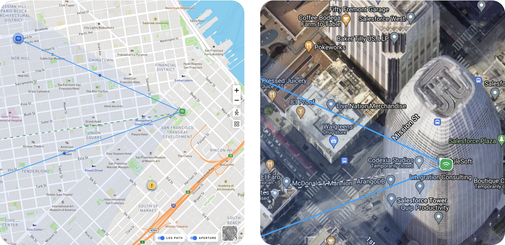
Street & Satellite View
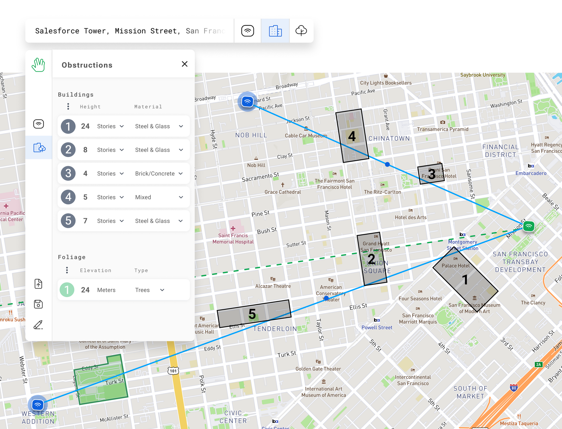
Street & satellite views make it easy to locate radio locations, identify surrounding infrastructure, and determine obstructions.
Leaving the nitty-gritty to the Google Maps API
Elevations at radio & obstruction points are automatically accounted for during analysis - there's no need to add them manually.
Simple drawing tools
The app uses formulas tailored to whichever morphology you've selected (dense urban, urban, rural, etc.) when setting the transmitting radio. However, if there are notably tall buildings or dense natural features like trees in the line-of-sight path, custom obstructions can be easily drawn on the map with a simple point & click and these obstructions will be included in the calculations.
Fire away!
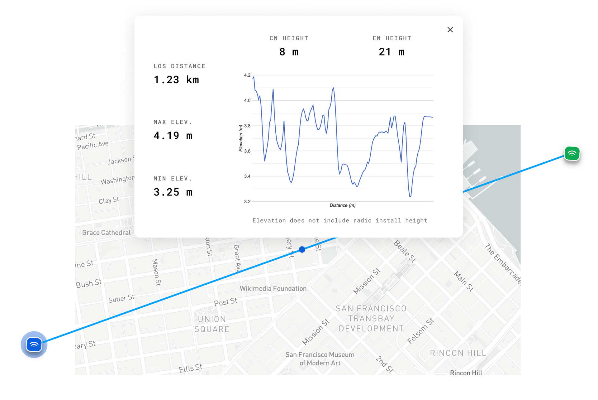
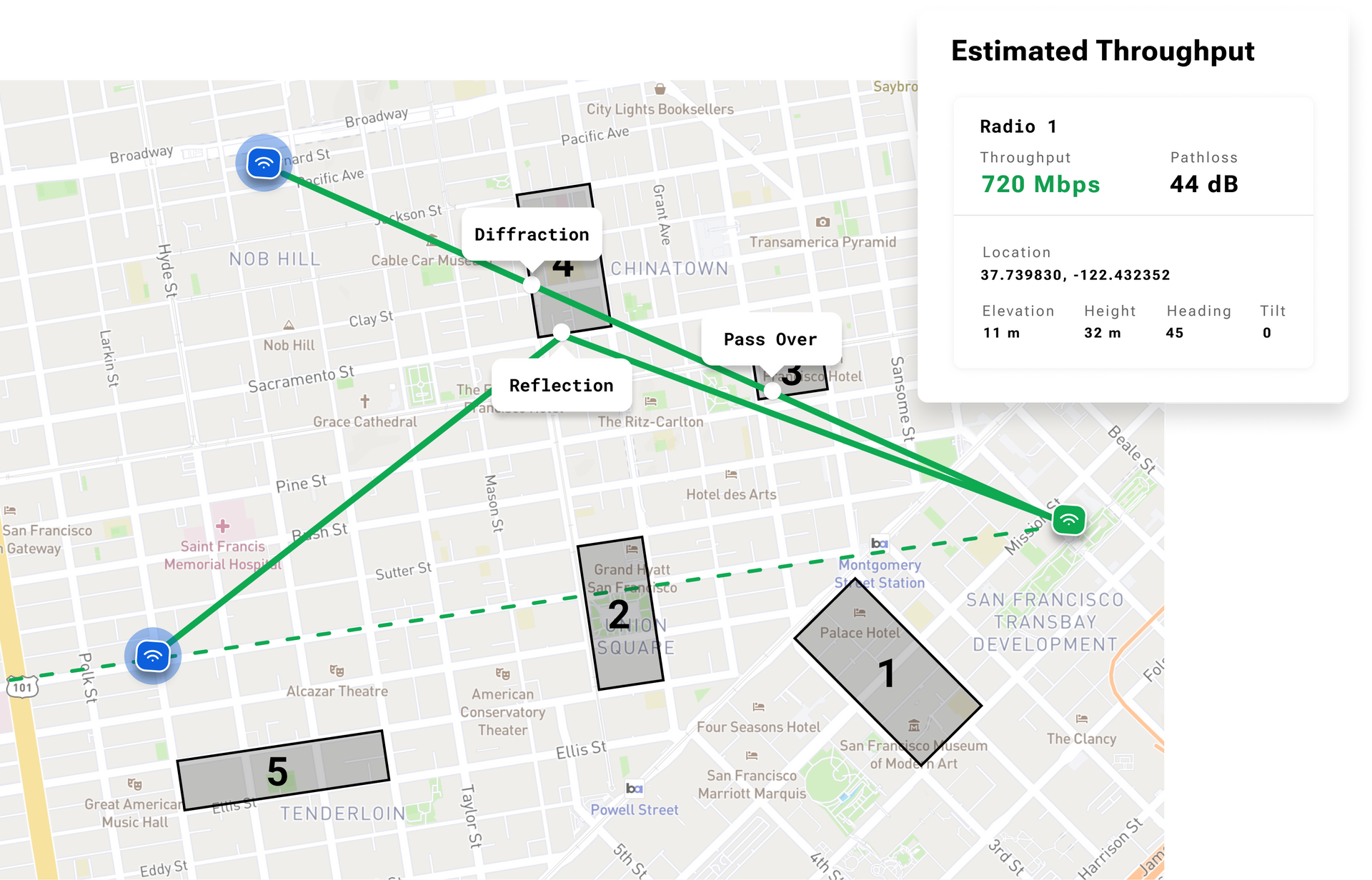
Once the scene has been set, click "run" to let the app take it from there, tracing all the rays and crunching all the numbers. Once the dust has settled, based on the parameters set and obstructions added, a throughput estimate is provided for each radio that successfully makes a link. The map also shows potential obstruction contact points and wave propagation events.
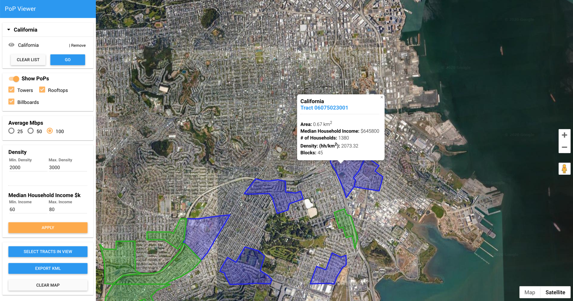
PoP Locator & Census Tract Map
This is a companion app for viewing census tract metrics, filtering by census data, and locating PoPs (Point of Presence towers). It's used to determine if there are already PoPs available for the install or if new structures will be required.