Improving the ZigAlert System for Operational Efficiency
Introduction
ZigAlerts are our critical system for real-time road information. They notify operators of road segments needing attention, guide vehicles through irregular conditions, and signal areas to avoid. This system enhances safety, efficiency, and error minimization — supporting fleet growth and maintaining high operational standards.
Discover how ZigAlerts will support fleet management and operational scalability.
What Are ZigAlerts and Why Are They Important?
ZigAlerts provide real-time road intelligence to our fleet. They indicate when specific road segments or lanes need special attention, guide vehicles through irregular conditions, and signal when to avoid certain areas altogether.
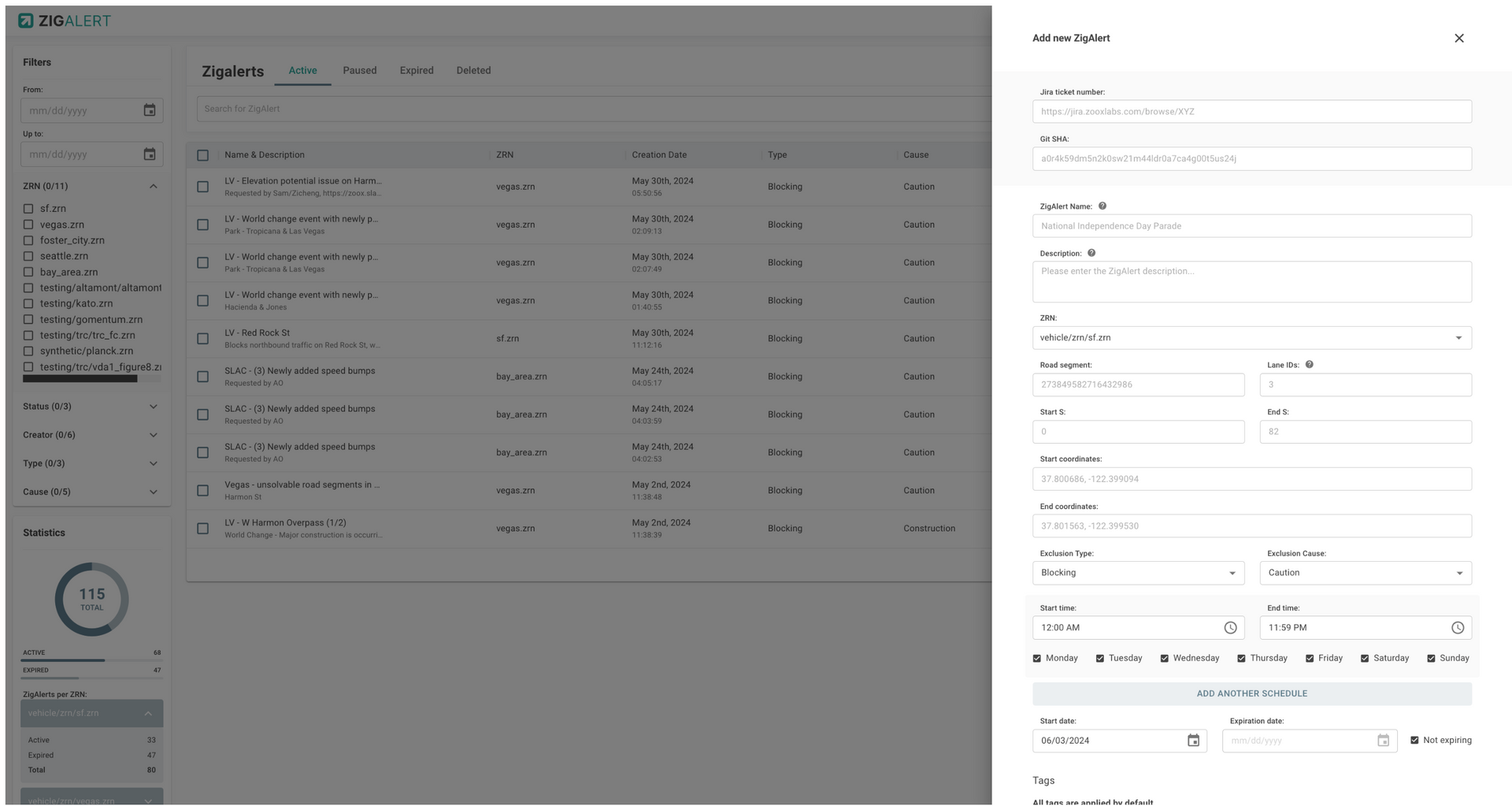
Currently, a single Cartographer monitors channels such as Slack and email for requests to create, modify, or remove ZigAlerts. That person implements the alerts through a web portal and monitors them daily. With numerous active ZigAlerts and a continuously expanding geofence area, this system plays a vital role in ensuring fleet safety and efficiency.
The Current Challenges
Relying on one individual introduces delays and potential errors. As operations expand, it’s no longer practical for a single person to handle growing, time-sensitive requests — for example, “Avoid this area” alerts that last only an hour and require immediate rerouting.
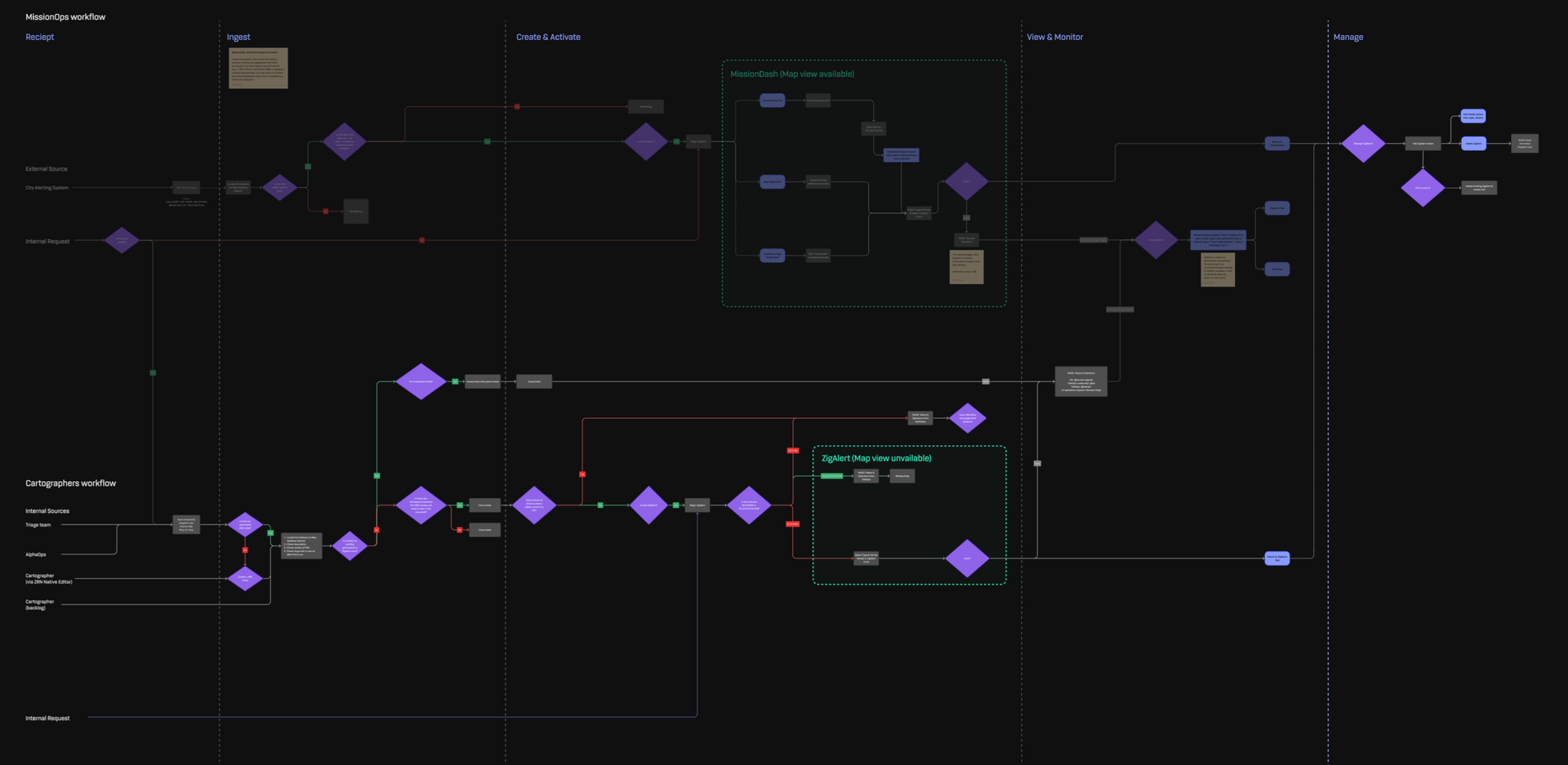
Mission Control to the Rescue
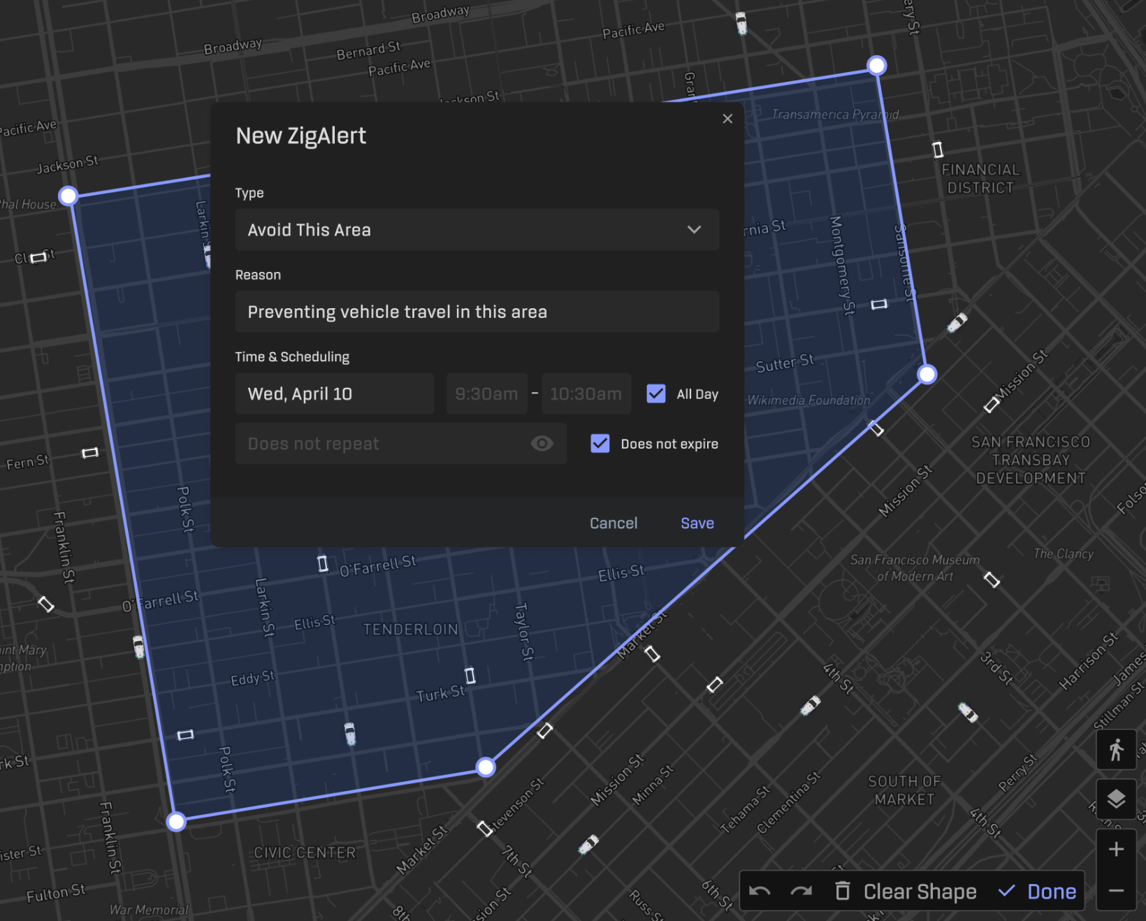
To improve efficiency and accuracy, the proposed solution expands ZigAlert functionality. Operators can create adjustable map boundaries defined by points or polygons to manage:
- Construction zones
- Incident areas
- City-mandated avoidance zones
- Other time-sensitive regions
New roles and responsibilities:
- Mission Operators: Create and manage ZigAlert content, providing immediate fleet guidance.
- Mission Operations Manager: Oversees and manages all active ZigAlerts.
- Routing Requests: Requests from AI, Cartography, QA, Policy, and Legal teams flow directly to the Mission Operations Manager.
This reorganization transfers ownership to Mission Control, eliminating dependency on a single individual and consolidating all ZigAlert requests into a single source of truth. The result: faster response times and reduced risk of missed requests.
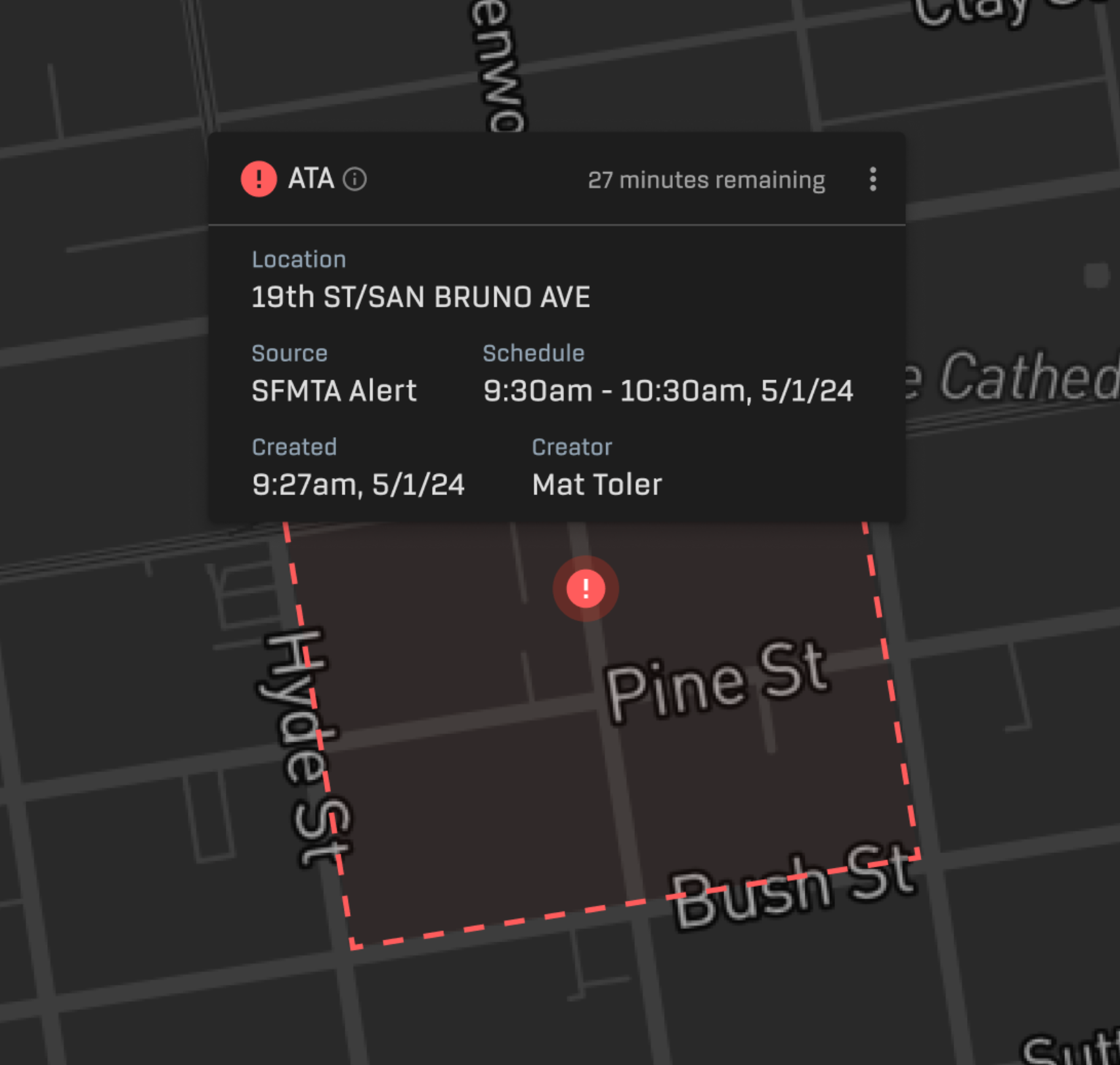
Bringing the ZigAlert Process to the Real World
Imagine “blind contour drawing” — drawing a subject without looking at the paper. That’s the challenge our Cartographer faces: creating geofences without visual validation.
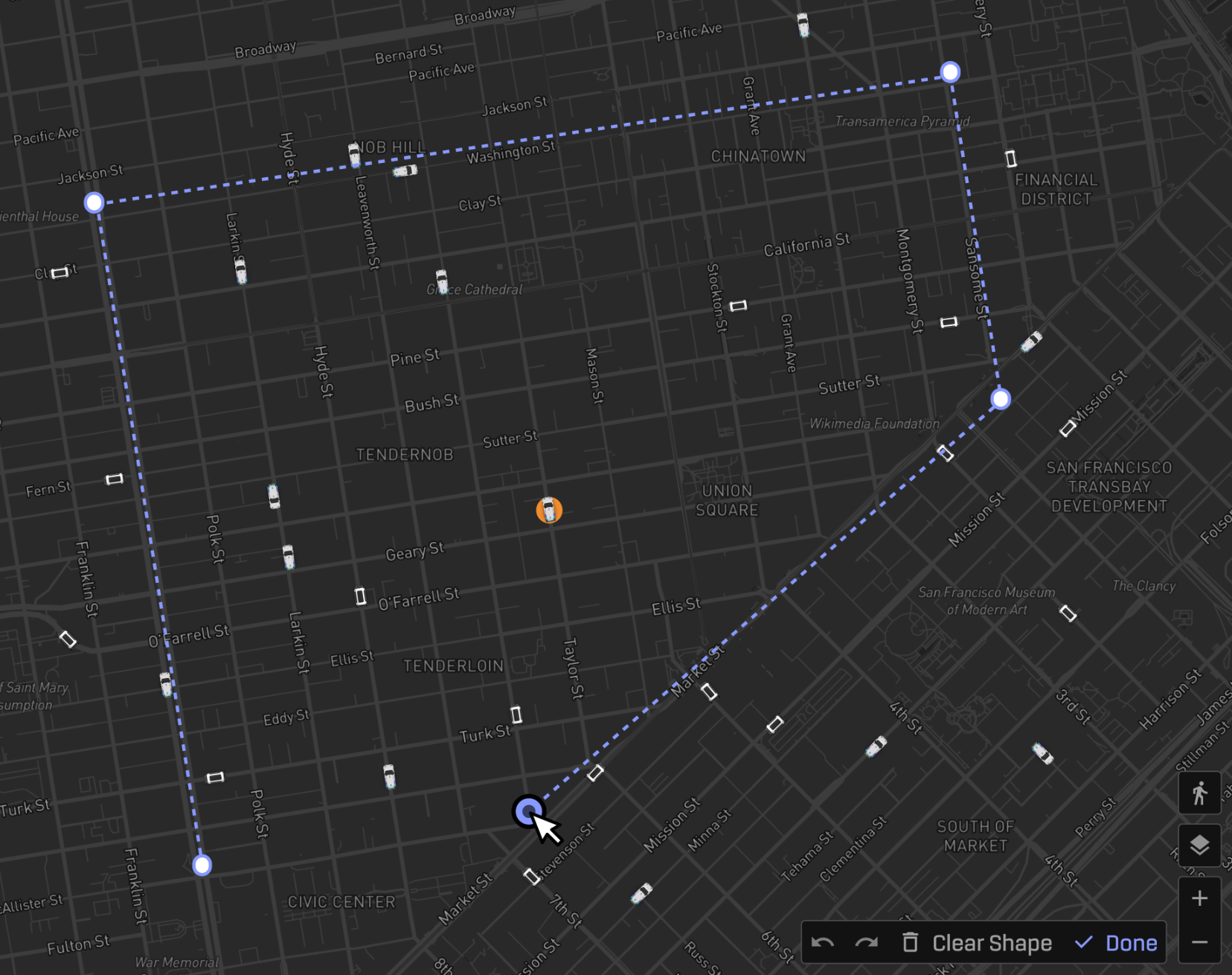
A visual interface for geospatial objects is essential. By introducing map-based visualization, we enable:
- Immediate spatial awareness
- Faster validation
- Fewer operational errors
- Scalable, intuitive management for dynamic environments
Conclusion
By implementing these improvements, our fleet can adapt quickly to dynamic road conditions, reduce risk, and maintain high operational standards as we scale. The enhanced ZigAlert workflow empowers Mission Control, strengthens safety, and supports long-term operational growth.